Maps (8)
![Submit a Featured Link: [$19.00]](/images/AddF_Button.gif)
![Submit a Regular Link: [$9.00]](/images/AddR_Button.gif)

- Top/Reference/Maps
- Top/Regional/Europe/Regions/Balkans/Maps and Views
- Top/Science/Social Sciences/Geography

 Ground Activity Update Ground Activity Update   - Includes Serbian ground activity, movements of paramilitaries, and areas of forced depopulation. - http://www.stratfor.com/images/maps/groundactivity990402.gif    Approximate Range of Yugoslav Artillery Approximate Range of Yugoslav Artillery  - Map showing range of artillery, mortars, MLRS, and Frog 7 weapons. - http://www.stratfor.com/images/maps/kosovoartillery.gif Yugoslavian Airbases  - Shows map of 6 major Serbian airbases active during the war. - http://www.stratfor.com/images/maps/yugairbases.gif Areas of Ethnic Cleansing  - Map of areas in Serbia and Kosovo where atrocities took place. - http://www.stratfor.com/images/maps/ethniccleansing.jpg Kosovo [1913-1992] 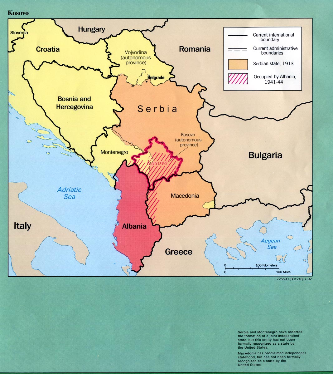 - Historical map of former Yugoslavia showing Kosovo, and what occupied it the 20th century. From the Central Intelligence Agency, 1992. - http://www.lib.utexas.edu/maps/europe/kosovo_history92.jpg Former Yugoslavia 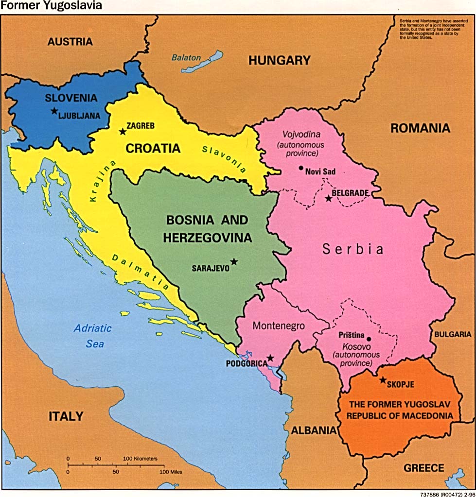 - Political map created in 1996 (162K) from the University of Texas Library. - http://www.lib.utexas.edu/maps/europe/fm_yugoslavia_pol96.jpg Former Yugoslavia - Ethnic Majorities 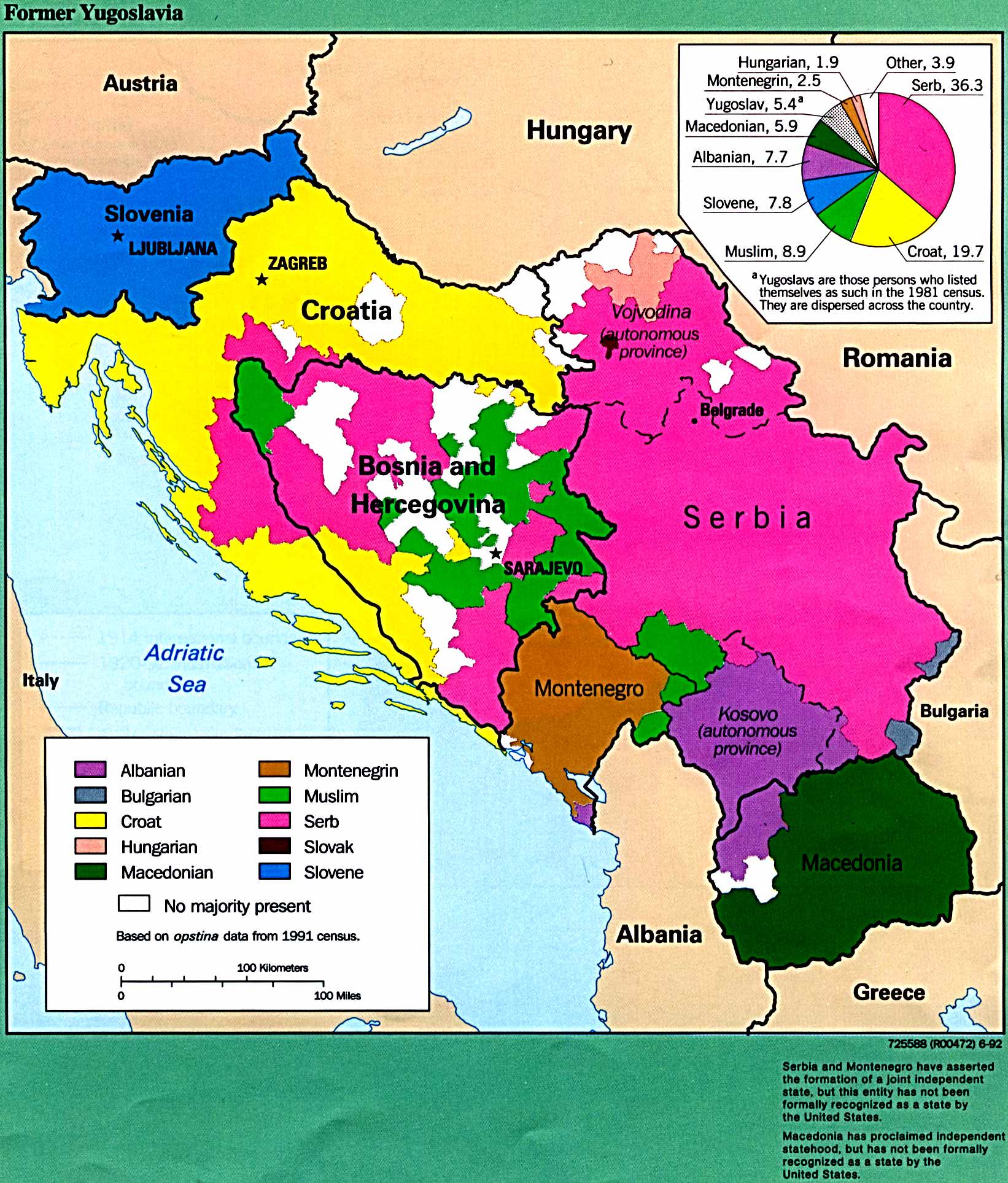 - A map showing ethnic divisions in 1992, (412K). Based on data from a 1991 census. - http://www.lib.utexas.edu/maps/europe/yugoslav.jpg Belgrade Map 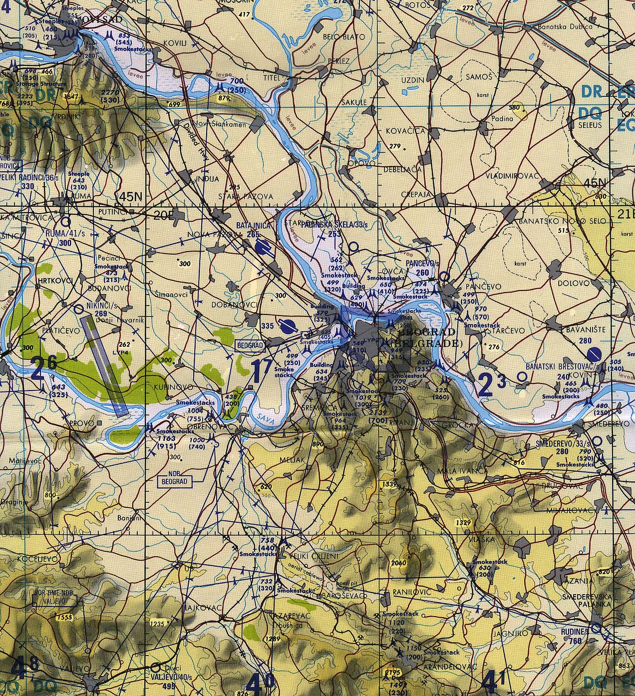 - Map with original scale 1:500,000 created in 1993 (839K), from the University of Texas Library. - http://www.lib.utexas.edu/maps/europe/belgrade_tpc93.jpg |
|