Maps and Views (5)
![Submit a Featured Link: [$19.00]](/images/AddF_Button.gif)
![Submit a Regular Link: [$9.00]](/images/AddR_Button.gif)


 National Geographic - MapMachine: Uruguay National Geographic - MapMachine: Uruguay   - Satellite, topographic, physical, street, earthquake, population and aerial maps and images. - http://plasma.nationalgeographic.com/mapmachine/profiles/uy.html    US NASA - Visible Earth: Uruguay US NASA - Visible Earth: Uruguay - Collection of NASA satellite and sensor images and animations. - http://visibleearth.nasa.gov/view_set.php?categoryID=2260 All Uruguay - Maps, geography, climate, economic and social indicators and tourist places. - http://www.terrazas.com.uy/uruguay_e/uindex_e.html Maps of Uruguay from Visit-Uruguay - Views of the country and its main departments and towns. - http://www.visit-uruguay.com/maps.htm University of Texas Libraries - Map of Uruguay 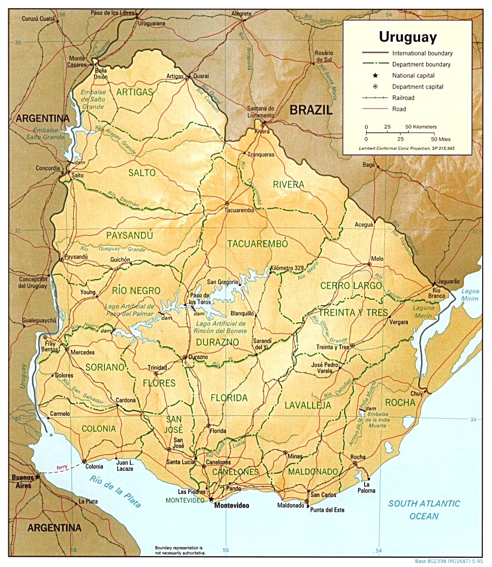 - Shaded Relief, 1995, from the Perry-Castañeda Library Map Collection at the University of Texas. (295K) - http://www.lib.utexas.edu/maps/americas/uruguay_rel_95.jpg |
|