Maps and Views (6)
![Submit a Featured Link: [$19.00]](/images/AddF_Button.gif)
![Submit a Regular Link: [$9.00]](/images/AddR_Button.gif)


 Fiji Islands Photos and Pictures Fiji Islands Photos and Pictures   - Photos and pictures of the Fiji Islands with images of cities and regions such as Nadi, Suva and the Fijian islands. - http://www.fiji-photos.com    Department of Mineral Resources Satellite Imagery Department of Mineral Resources Satellite Imagery - Interactive maps of the southernn coast of Viti Levu including Suva City. Maps include satellite images, geological information and seismic microzonation. - http://map.mrd.gov.fj Fiji Islands Picture and Travel Guide - Travel information for vacations in the Fiji Islands with pictures of Fijian people, adventure, culture, sunsets, resorts and islands. - http://www.fiji.islands-pictures.com Map of Fiji 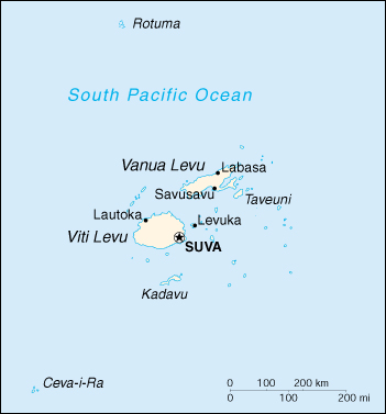 - Map of Fiji from the Perry-Castañeda Library map collection. - http://www.lib.utexas.edu/maps/cia00/fiji_sm00.jpg Fiji Picture Library - Contains dozens of Fiji pictures in categories from beaches to towns to lifestyle. Includes a series of maps as well. - http://www.fijivision.com/Pictures.html Royalty Free Maps - Includes color and black and white maps of Viti Levu, Vanua Levu, Kadavu island, Yasawa islands, Mamanuca islands and the Lau islands. All maps are in PDF format. - http://www.underwatercolours.com/fiji/fijimaps.html |
|