Maps and Views (7)
![Submit a Featured Link: [$19.00]](/images/AddF_Button.gif)
![Submit a Regular Link: [$9.00]](/images/AddR_Button.gif)


 Virtual Reality Panoramas: North of the Golden Gate Virtual Reality Panoramas: North of the Golden Gate   - Approximately 300 panoramas of landscapes throughout northern California. Includes areas such as the redwoods, Lake Tahoe, Mount Lassen area, and Marin County. - http://www.virtualguidebooks.com/NorthCalif/NorthCalif.html    Weather Maps Weather Maps - Interactive map in which user clicks on an area and receives weather forecast from the National Weather Service. Plus satellite and radar imagery. - http://www.wrh.noaa.gov/Eureka/ Tourism Map and Travel Information - Map of Northern California with links to visitor information for each county. - http://www.shastacascade.org/regptg.htm Shaded Relief Map  - A brightly colored map of the northern half of California made by color-coding elevations and applying shadows. (474K) - http://fermi.jhuapl.edu/states/maps1/ca_north.gif Northern California 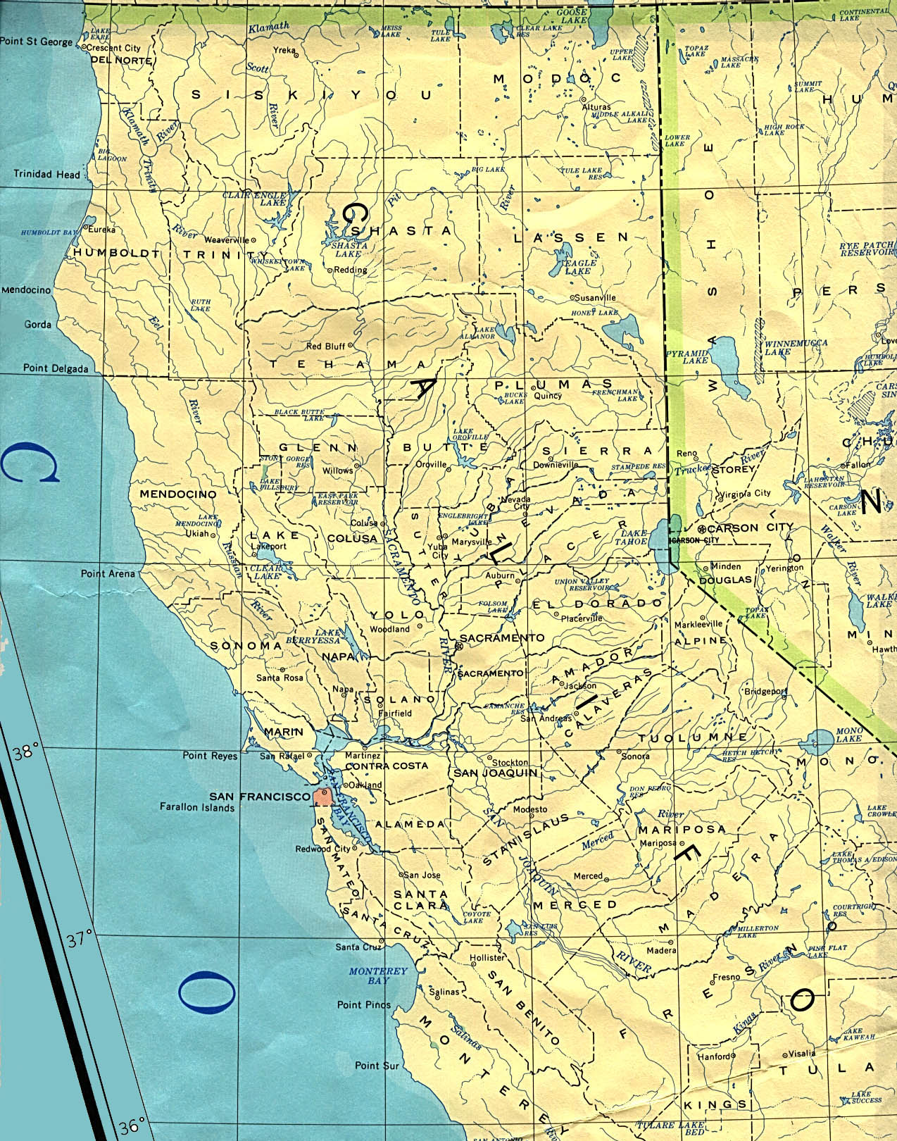 - Original scale 1:2,500,000 U.S.G.S. 1972, limited update 1990. In Perry-Castañeda Library Map Collection. (604K) - http://www.lib.utexas.edu/maps/united_states/california_north_90.jpg Historial Map of the Mining District of California - A 1851 color map showing the area from the San Francisco Bay Area east to the gold mining areas of the Sierra Nevada foothills. - http://memory.loc.gov/cgi-bin/query/r?ammem/gmd:@field(NUMBER+@band(g4361h+mf000061)) Road Maps - A basic highway map of Northern California, along with more detailed road maps of the San Francisco, Sacramento, and Lake Tahoe areas. - http://www.aaccessmaps.com/show/map/californianorth |
|