Maps and Views (10)
![Submit a Featured Link: [$19.00]](/images/AddF_Button.gif)
![Submit a Regular Link: [$9.00]](/images/AddR_Button.gif)


 Air Quality Information Air Quality Information   - Current SMOG conditions in Los Angeles, Orange, and eastern San Bernardino and Riverside Counties. - http://www.aqmd.gov/telemweb/areamap.aspx    Historical View of Los Angeles Area, 1871 Historical View of Los Angeles Area, 1871 - A color bird's-eye view showing the area, along with text, a border showing major events in area history, and an index to points of interest. - http://memory.loc.gov/cgi-bin/query/r?ammem/gmd:@field(NUMBER+@band(g4364l+pm000231)) Virtual Reality Panoramas: Los Angeles and Vicinity - Panoramas of scenic landscapes, including ones in Malibu, Los Angeles, the San Fernando and San Gabriel Valleys, and coastal Orange County. - http://www.virtualguidebooks.com/SouthCalif/LosAngeles.html Road Maps - A basic highway map of the Metro Area, along with more detailed road maps of Long Beach, Los Angeles, Anaheim, Beverly Hills, LAX, Santa Ana, and Santa Monica. Plus satellite photo of the area. - http://www.aaccessmaps.com/show/map/us/ca/lametro Road Map with Points of Interest - Shows major highways, primary roads, communities, and points of interest in Los Angeles and Orange County. Provided by California Division of Tourism. - http://gocalif.ca.gov/tourism/pdfs/LA_OC_Map.pdf Recent Earthquakes - Map and detailed information about recent seismic activity from the U. S. Geological Survey. - http://quake.usgs.gov/recenteqs/Maps/Los_Angeles.htm Los Angeles Metro Area 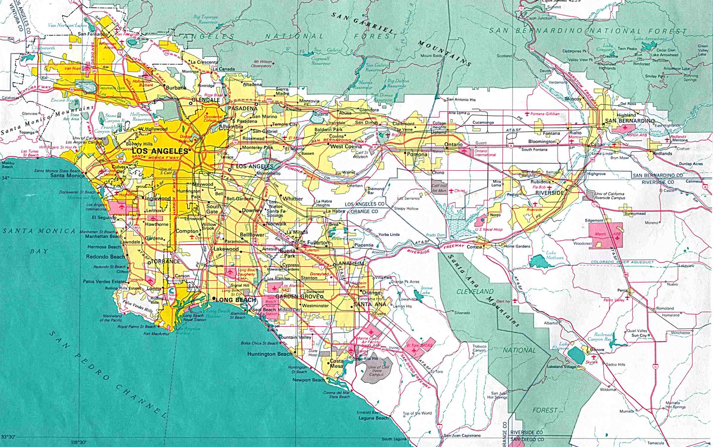 - From the 1970 edition of the U.S. National Atlas. (326K) - http://www.lib.utexas.edu/maps/world_cities/los_angeles.jpg Highway System Area Maps - Showing current road conditions for highways in Los Angeles and Ventura counties. - http://www.dot.ca.gov/hq/roadinfo/do7map.htm Atlas of Metropolitan Los Angeles and Vicinity - Includes maps showing population, citizenship, income, poverty, and education. - http://130.166.124.2/LA_1.html Views of Street Life - Web cam mounted on the dashboard of a van captures scenes of daily life on the streets of Los Angeles, San Bernardino, and Orange Counties. - http://www.laavenue.com/la/livecam.htm |
|